Agreeing on what will make Tullamore better is not a simple task
O’Connor Square, Tullamore is in the news because of the proposed enhancement works for Tullamore based on a budget of €3m which will see Main Street connected to the Bridge Centre, the laying underground of cables in some of the streets and the re-ordering of O’Connor Square to remove the motor car, in so far as politically possible. What are proposed now are enhancement works to have more pedestrianisation and less of the motor car. It is not planning in the grand manner as the owner of the town, Charles William Bury, the earl of Charleville, was able to do in the fifty years of great expansion in Tullamore from the 1780s to the 1830s. That is the subject of this review, but in looking at the historical record, it is interesting to see how decisions taken at particular junctures over the past 300 years of the town’s history can have an adverse impact later.
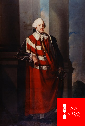
- Charles Moore, 1st Earl of Charleville (d.1764)
The first earl of Charleville has a go at planning a better Tullamore
When Charles Moore, the first earl of Charleville, succeeded his father in 1725 the town was not much more than Barrack/Patrick Street. His mother paid for the first Protestant church in the town in 1726 in Church Street. The family lived near the harbour until Moore bought and developed the old house at Redwood, now Charleville, in about 1740. This was shortly after his marriage and it may be that he was now spending more time in Tullamore and giving more attention to its development. Moore died in 1764 and in reviewing the town’s progress the great agriculturalist, Arthur Young, said of the place in 1776: ‘Part of Tullamore is well built. Young was almost certainly referring to Bridge Street, High Street and O’Connor Square (formerly Charleville Square). Of the six properties in Bridge Street three of the houses were erected before 1784; a fourth was erected earlier, possibly in the 1720s. The last mid-eighteenth century house to go up in Bridge Street was erected by John Vaughan, a merchant, in 1756 (the former Hoey & Denning, demolished in 1992). On the western side of the market place (not called Charleville Square until after 1800) and further up High Street houses were erected from at least 1713. Unfortunately it is difficult to pinpoint their location. In both High Street and O’Connor Square the best houses were erected in the 1740s and 1750s. About ten of these survive. There is no evidence to show building in Columcille Street (formerly William Street or Pound Street) before 1790 except possibly a row of cabins on the south west side. In Church Street (formerly Church Lane) only the western half of the present street as far as the church was developed. East of the church was the linen factory building erected in 1754. This was situated near the river, but did not occupy a position corresponding with the modern street line of O’Carroll Street. Also near the river on the eastern side of the town was Lord Tullamore’s house erected c. 1700 and in use until the 1740s. On the western extremity of the town was the barracks and on the southern side the last of the High Street houses and the windmills. The building of cabins on the perimeter of the town near the town turf banks seems to have been common and the extent of this development is clear-cut from the 1838 OS map and the 1840s valuation records. Of the twenty houses for which there are memorials in the Registry of Deeds five were erected in the 1740s and nine in the 1750s. Up to ten more houses are mentioned in leases. When one includes properties about which we are less sure of their exact location the total number of houses in the town in the 1770s (exclusive of cabins on back gardens or the perimeter of town) was about fifty.
Wider streets desired for Bridge Street and High Street and a spacious square
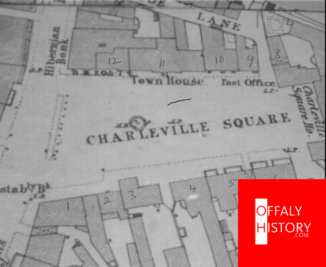
No serious effort was made at town planning in Tullamore before the 1780s. Patrick Street was almost entirely rebuilt after 1786, but Church Street Upper and Bridge Street have retained their narrow street widths of 30 and 36 feet, respectively. From the late 1740s it was decided to have wider streets. In granting a lease to Tyrrell in 1748 the street line was pushed back by ten feet in Bridge Street (now Douglas Jewellery). In High Street the width is forty eight feet. It must have been the landlord’s intention to develop a square in the 1750s when two building leases were granted for houses on the southern side. In the previous decade one house with a projecting two-storey wing to the front was erected on this side of the square (the Gray Cuniffe building). In the next three houses, front and elevation was standardised. The eastern side of the square and the western sides (1-4 High Street in the later valuation records) were already built but nothing was done with the northern side which left the square unfinished until the late 1780s.It appears that this was intentional so as to leave an area free for the court house and market house erected in 1789.
Tullamore was owned by a child of five weeks in 1764 and building stopped for 20 years
The first Lord Charleville (died 1764) did attempt to lay out the town when houses were built in High Street and O’Connor Square in the 1740s and 1750s, but the work was never finished because economic development was slow. Neither did he leave a direct heir such that the town was owned by a child of five weeks in 1764. With no power to grant building leases nothing happened in Tullamore for twenty years until 1785. The entire Charleville estate in King’s County including Tullamore town was surveyed in 1786 a year after Bury came of age (unfortunately the atlas created for this exercise has not been seen for sixty years). It may be that Patrick Street (or perhaps its southern side) which had been damaged in the fire was widened and rebuilt. All the residents here got new leases. The remaining plots in O’Connor Square were granted in the same year. In 1789 a market house was erected in the square to complete the process. New street development began in 1790 when the architect, John Pentland, laid out Columcille Street (then called Pound Street and later William Street) in building plots. This street was a continuation of High Street and Bridge Street. Near the centre of the street on the eastern side a site was reserved for a new court house. This did not proceed when Harbour Street was developed after 1800. Most of the houses erected here were owned by Thomas Acres, a building speculator, who had been granted most of the plots in this street. These houses were all uniform in size and height. Only on the south-western side were there single-storeyed thatched houses. These were owned by Thomas Manly who was in possession of the property long before 1786. In the 1790s only upper Church Street and Patrick Street were at right-angles to Columcille Street. But after 1800 Offaly Street, Harbour Street and Convent Road were added. By 1810 the town had the familiar grid-iron pattern with a market square and also a tree-lined ‘Bachelors Walk’ near the town. Harbour Street was not completed until the 1820s. The old Protestant church and linen factory in Church Street were demolished at the same time and a new market square or corn market provided. The last of the planned streets was erected in the 1830s and was made sufficiently wide to give a full view of the county infirmary at its western end. So crucially to our story of O’Connor Square the residents got rid of the noxious stuff and trades and moved the marketing function to the new Cornmarket or Market Square. Off the new square was built the new shambles for meat sales and a place for people to sell livestock and vegetables. Charleville Square had now gone respectable, but there was one problem. Just off was Tanyard Lane with initially tanning works, later two breweries and finally malting houses. In the vicinity of what is now Oisin O’Sullivan’s was, from the 1840s to the 1870s a smelly slaughter yard and provisioning warehouse. Worse, possibly in the 1790s it had been decided to improve the access to the Tanyard from the Geashill Road. So the problems of the needs of traffic and light industry are two centuries old. All that is different is the demand to park vehicles because there are so many of them about.
